31 Jul 2022
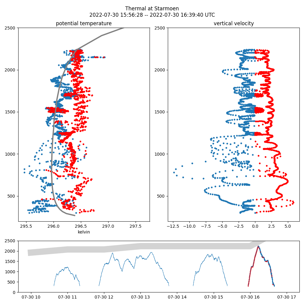
During the summer school we were very interested in the comparison between observations and weather prediction systems.
Below you can see the flight data collected by the glider LN-GMI on the 30th of July, compared to the HARMONIE-AROME model used by the Norwegian MET office.

24 Jul 2022
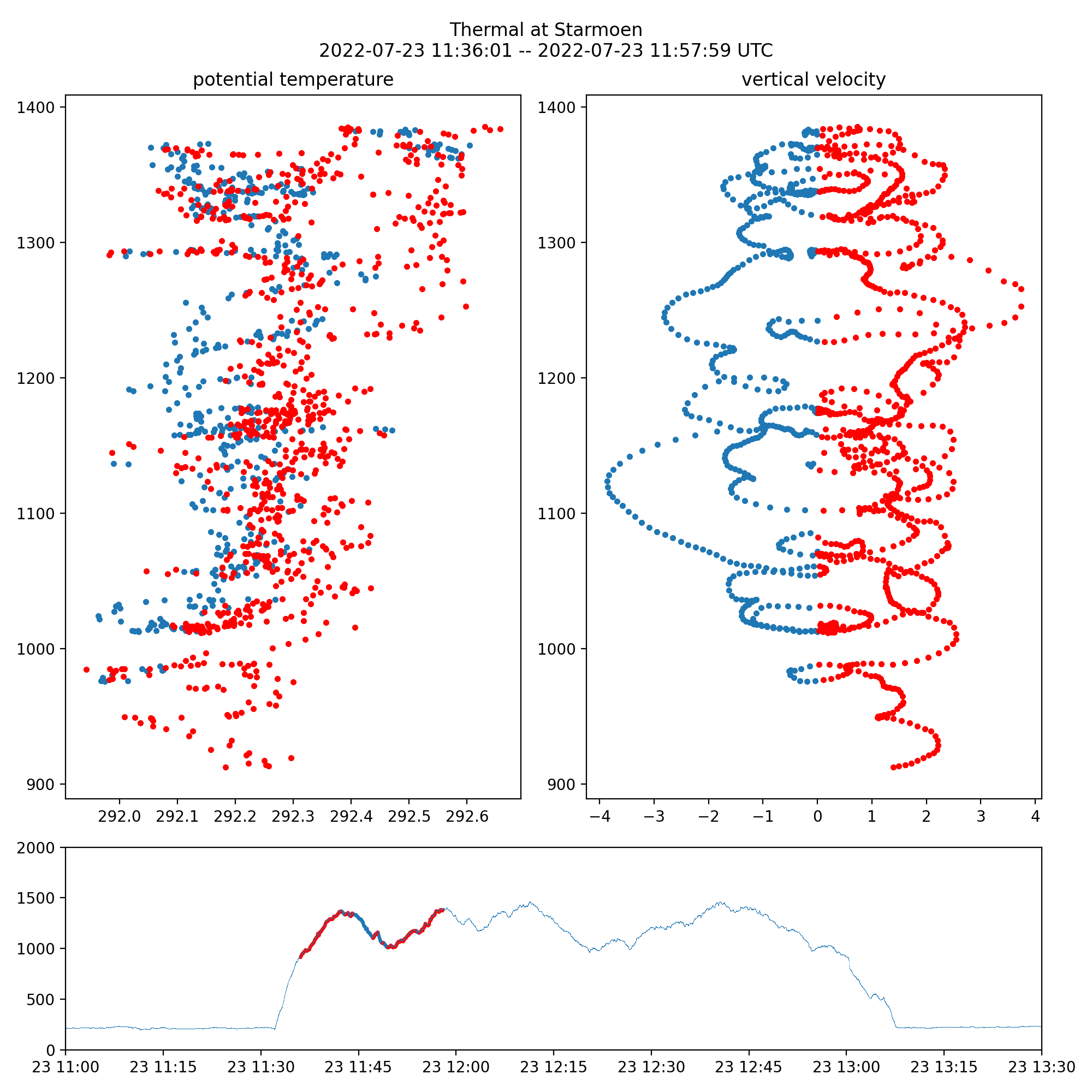
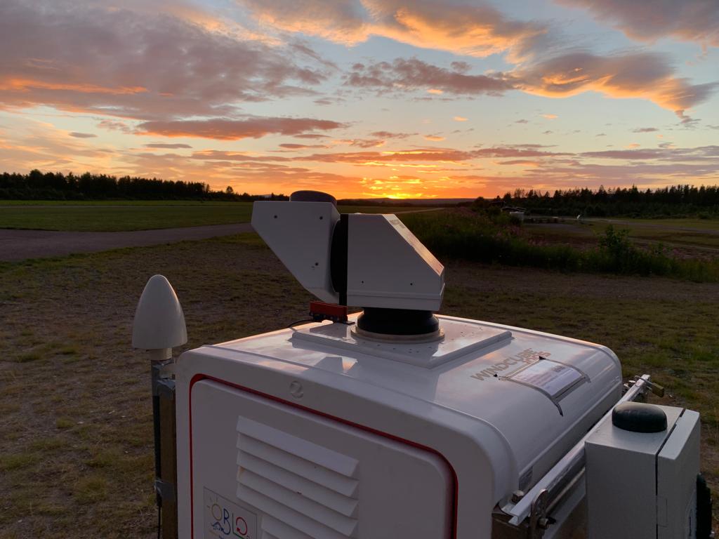
Here you can see the set-up of the LIDAR instruments at Starmoen. The is an example of the data from the glider pilots at Starmoen and the LIDAR observations.
The checkboxes on the top allow you to hide parts of the scene. Dragging the timeline or hitting play will update the visualization.
23 Jul 2022

20 Jul 2022
Here is an example of the overlap between paragliding and LIDAR observations.
The checkboxes on the top allow you to hide parts of the scene. Dragging the timeline or hitting play will update the data.
18 Jul 2022
Thanks to Christiane and Tom, the LIDARs are up and running at the Starmoen airfield.


